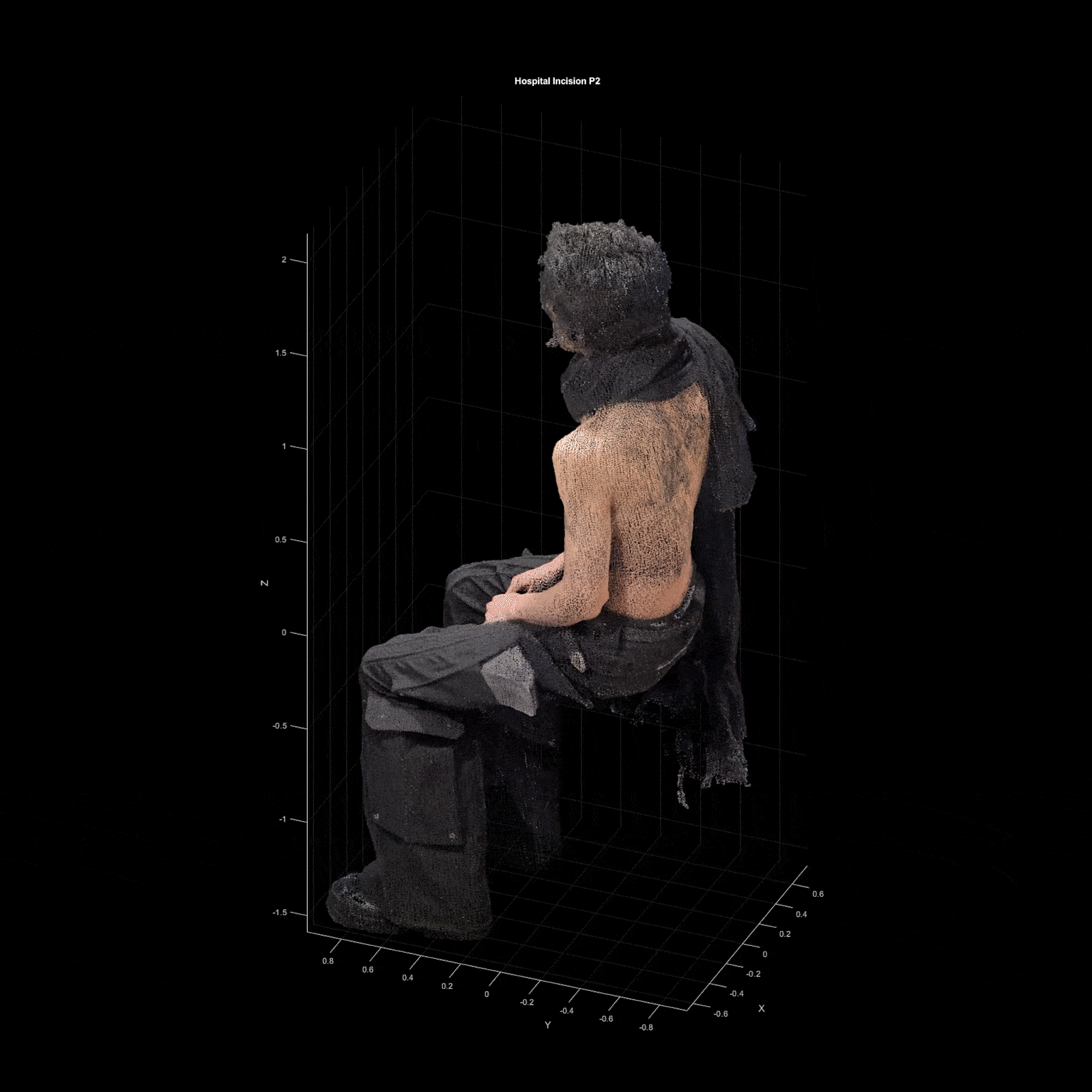
Hospital_Soldiers
The models below have been created by converting video recordings of the subject into point clouds using computer vision software. The models were then imported into MATLAB and visualized using the following code.


clc;
clear all;
% Path to the PLY file
plyFilePath1 = 'G:\My Drive\Hospital\campaign 2024\incision p2\point clouds\point1.ply';
plyFilePath2 = 'G:\My Drive\Hospital\campaign 2024\incision p2\point clouds\Gal-ad - Cloud.ply';
% Specify the output PLY file path
outputFilePath = 'G:\My Drive\Hospital\campaign 2024\incision p2\point clouds\final\pointCloud.ply';
% Read and rotate the point cloud
Rvector1 = [0,0,90];
Rvector2 = [90,0,0];
rotatedPtCloud1 = readAndRotatePointCloud(plyFilePath1,Rvector1);
rotatedPtCloud2 = readAndRotatePointCloud(plyFilePath2,Rvector2);
displayPointCloud(rotatedPtCloud1);
% displayPointCloud(rotatedPtCloud2);
% Scale the point cloud
scaledPtCloud1 = scalePointCloud (rotatedPtCloud1,1.5);
scaledPtCloud2 = scalePointCloud (rotatedPtCloud2,1);
% Call the function to center the point cloud at (0, 0, 0)
centeredPtCloud1 = centerPointCloud(scaledPtCloud1);
centeredPtCloud2 = centerPointCloud(scaledPtCloud2);
% Define coordinate ranges for filtering (X, Y, Z) for first point cloud
xRange1 = [-3 2];
yRange1 = [-2 1];
zRange1 = [-2 2];
% Filter the point cloud based on specified coordinate ranges
filteredPtCloud2 = filterPointCloud(centeredPtCloud2, xRange1, yRange1, zRange1);
% Translate the point clouds
translationVector1 = [-1.7, 0.5, 1.4];
translationVector2 = [0, 0, 0];
% Call the function to translate the point cloud
translatedPtCloud1 = translatePointCloud(centeredPtCloud1, translationVector1);
translatedPtCloud2 = translatePointCloud(filteredPtCloud2, translationVector2);
% displayPointCloud(translatedPtCloud1);
% displayPointCloud(translatedPtCloud2);
% Combine point clouds
combinedPtCloud = mergePointClouds(translatedPtCloud1, translatedPtCloud2);
displayPointCloud(combinedPtCloud);
% % Save the filtered point cloud
% saveFilteredPointCloud(combinedPtCloud, outputFilePath)
function displayPointCloud(ptCloud)
% Create a figure to display the point cloud
figure;
pcshow(ptCloud);
title('Rotated 3D Point Cloud');
xlabel('X');
ylabel('Y');
zlabel('Z');
grid on;
axis equal; % Equal scaling for all axes
view(3); % Set the default 3D view
en
function combinedPtCloud = mergePointClouds(ptCloud1, ptCloud2)
% Check if both inputs are valid pointCloud objects
if ~isa(ptCloud1, 'pointCloud') || ~isa(ptCloud2, 'pointCloud')
error('Both inputs must be valid pointCloud objects.');
end
% Concatenate the point locations (XYZ coordinates) of both point clouds
combinedPoints = [ptCloud1.Location; ptCloud2.Location];
% Check if both point clouds have color data
if ~isempty(ptCloud1.Color) && ~isempty(ptCloud2.Color)
% Concatenate the color data if both point clouds have colors
combinedColors = [ptCloud1.Color; ptCloud2.Color];
% Create a new point cloud object with the combined points and colors
combinedPtCloud = pointCloud(combinedPoints, 'Color', combinedColors);
else
% If no color data is available, create the point cloud without color
combinedPtCloud = pointCloud(combinedPoints);
end
end
%% Function to save the filtered point cloud to a PLY file
function saveFilteredPointCloud(filteredPtCloud, outputFilePath)
% Save the filtered point cloud to a PLY file
pcwrite(filteredPtCloud, outputFilePath, 'PLYFormat', 'Binary');
disp(['Filtered point cloud saved to: ', outputFilePath]);
end